File:Fimmvorduhals second fissure 2010 04 02.JPG
From WikiEducator
Size of this preview: 800 × 533 pixels. Other resolution: 4,752 × 3,168 pixels.
Original file (4,752 × 3,168 pixels, file size: 9.59 MB, MIME type: image/jpeg)
|

Summary
| Description |
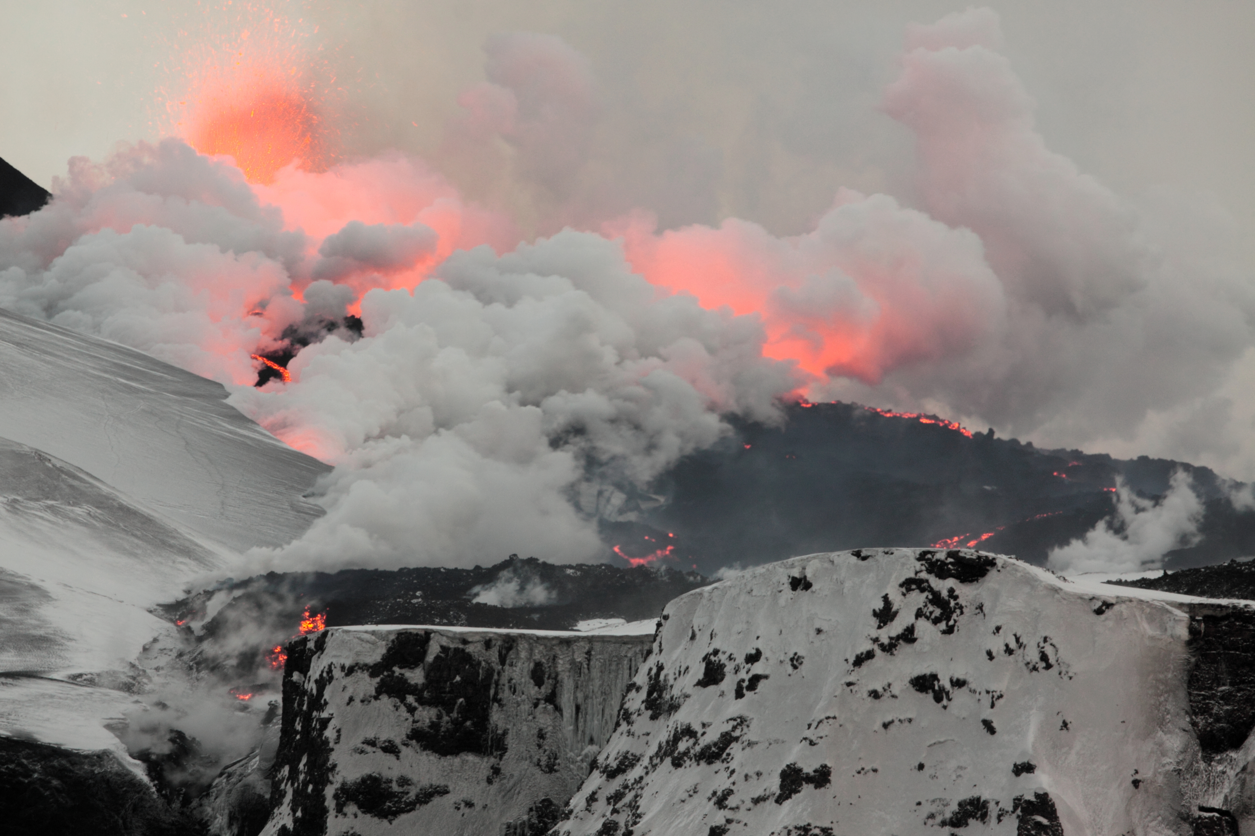
English: Overview of the 2nd fissure on Fimmvörðuháls, close to Eyjafjallajökull, as the lava flows down towards the north, turning snow into steam.
|
| Date | |
| Source | Own work |
| Author | Boaworm |
| Camera location | | View this and other nearby images on: OpenStreetMap |
|---|
Licensing
I, the copyright holder of this work, hereby publish it under the following license:
This file is licensed under the Creative Commons Attribution 3.0 Unported license.
- You are free:
- to share – to copy, distribute and transmit the work
- to remix – to adapt the work
- Under the following conditions:
- attribution – You must give appropriate credit, provide a link to the license, and indicate if changes were made. You may do so in any reasonable manner, but not in any way that suggests the licensor endorses you or your use.
File history
Click on a date/time to view the file as it appeared at that time.
| Date/Time | Thumbnail | Dimensions | User | Comment | |
|---|---|---|---|---|---|
| current | 03:37, 26 January 2013 | | 4,752 × 3,168 (9.59 MB) | Slick-o-bot | Bot: convert to a non-interlaced jpeg (see bug #17645) |
File usage
The following page links to this file: