File:Thailand.A2001334.0350.500m.jpg

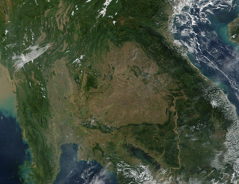
Southeast Asia.
On November 30, 2001, MODIS captured this image of southeastern Asia. The image focuses on the countries of Myanmar, Thailand, Laos, Cambodia, and Vietnam, left to right respectively. In eastern Thailand, the brown coloring that dominates the center of the image and mimics the country's border with Laos and Cambodia, speaks of the massive deforestation that occurs in this region. One of southeastern Asia's prominent environmental concerns, deforestation has played a major role in flooding in the region. There have also been incidents where portions of Thailand's traditional waterway transport system have been clogged by siltation as a result of deforestation.
http://visibleearth.nasa.gov/view_rec.php?id=2316 archive copy at the Wayback Machine
| This file is in the public domain in the United States because it was solely created by NASA. NASA copyright policy states that "NASA material is not protected by copyright unless noted". (See Template:PD-USGov, NASA copyright policy page or JPL Image Use Policy.) | ||
 |
Warnings:
|
File history
Click on a date/time to view the file as it appeared at that time.
| Date/Time | Thumbnail | Dimensions | User | Comment | |
|---|---|---|---|---|---|
| current | 08:28, 27 October 2005 | | 2,600 × 2,000 (1.04 MB) | Brian0918 | Southeast Asia. On November 30, 2001, MODIS captured this image of southeastern Asia. The image focuses on the countries of Myanmar, Thailand, Laos, Cambodia, and Vietnam, left to right respectively. In eastern Thailand, the brown coloring that dominates |
File usage
The following page links to this file: