File:Quinlan Bridge 1.JPG
From WikiEducator

Size of this preview: 800 × 600 pixels. Other resolution: 2,592 × 1,944 pixels.
Original file (2,592 × 1,944 pixels, file size: 2.09 MB, MIME type: image/jpeg)
|
This is an image of a place or building that is listed on the National Register of Historic Places in the United States of America. Its reference number is 74000208. |
Summary
| Description |
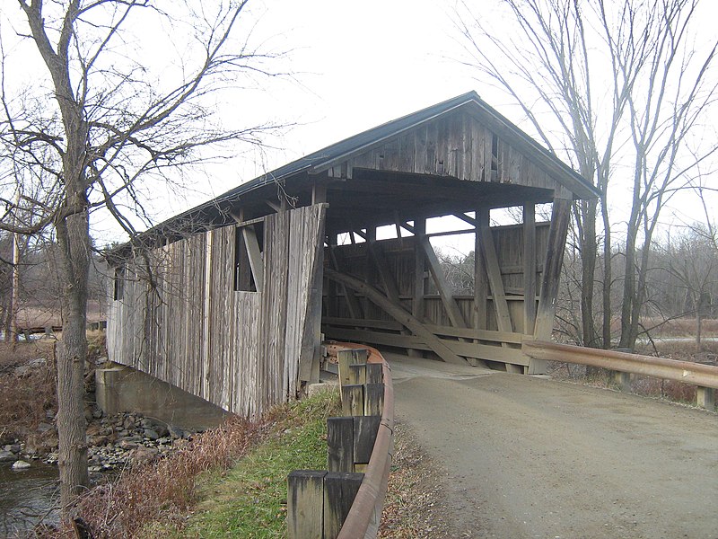
English: Quinlan (a/k/a "Lower") Covered Bridge, Charlotte, Vermont. The name comes from one John Quinlan, an Irish immigrant who was owner of a mill and manufacturing (butter tubs) complex just upstream from here in the late 1800s. Looking at the history, one would expect the name to be Sherman (the family who owned the mill when the bridge was built); instead it is named for someone who did not even arrive in the neighborhood until more than fifteen years later.
Kingpost Burr Arch construction, 1849 builder unknown, 88 feet, spanning Lewis Creek on Covered Bridge Road. |
| Date | |
| Source | Own work |
| Author | Mfwills |
| Object location | | View this and other nearby images on: OpenStreetMap |
|---|
Licensing
I, the copyright holder of this work, hereby publish it under the following licenses:
This file is licensed under the Creative Commons Attribution-Share Alike 3.0 Unported license.
- You are free:
- to share – to copy, distribute and transmit the work
- to remix – to adapt the work
- Under the following conditions:
- attribution – You must give appropriate credit, provide a link to the license, and indicate if changes were made. You may do so in any reasonable manner, but not in any way that suggests the licensor endorses you or your use.
- share alike – If you remix, transform, or build upon the material, you must distribute your contributions under the same or compatible license as the original.

|
Permission is granted to copy, distribute and/or modify this document under the terms of the GNU Free Documentation License, Version 1.2 or any later version published by the Free Software Foundation; with no Invariant Sections, no Front-Cover Texts, and no Back-Cover Texts. A copy of the license is included in the section entitled GNU Free Documentation License. |
You may select the license of your choice.
File history
Click on a date/time to view the file as it appeared at that time.
| Date/Time | Thumbnail | Dimensions | User | Comment | |
|---|---|---|---|---|---|
| current | 01:49, 6 December 2010 | | 2,592 × 1,944 (2.09 MB) | Mfwills | {{Information |Description={{en|1=Quinlan (a/k/a "Lower") Covered Bridge, Charlotte, Vermont. The name comes from one John Quinlan, an Irish immigrant who was owner of a mill and manufacturing (butter tubs) complex just upstream from here in the late 1800 |
File usage
The following page links to this file: