File:Groundplan of Te Rangihaeata's pa Pauatahanui Inlet 1846.jpg

Summary
| Description |
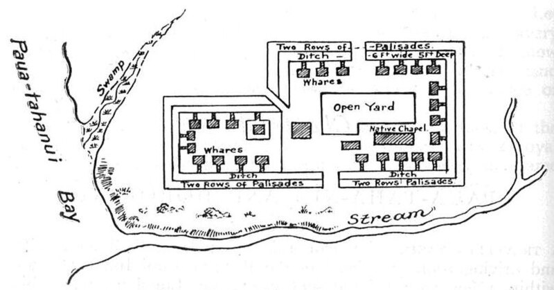
English: Ground-plan of Te Rangihaeata's pa. At the head of Pauatahanui Inlet, 1846 |
| Date | |
| Source | The New Zealand Wars |
| Author | James Cowan |
Licensing
|
This work is in the public domain in its country of origin and other countries and areas where the copyright term is the author's life plus 70 years or fewer.
| |
| This file has been identified as being free of known restrictions under copyright law, including all related and neighboring rights. | |
File history
Click on a date/time to view the file as it appeared at that time.
| Date/Time | Thumbnail | Dimensions | User | Comment | |
|---|---|---|---|---|---|
| current | 19:04, 12 October 2009 | | 810 × 424 (63 KB) | Mosborne01 | {{Information |Description={{en|1=Ground-plan of Rangihaeata's pa. At the head of Pauatahanui Inlet, 1846}} |Source=The New Zealand Wars |Author=James Cowan |Date=1922 |Permission= |other_versions= }} |
File usage
The following page links to this file: